
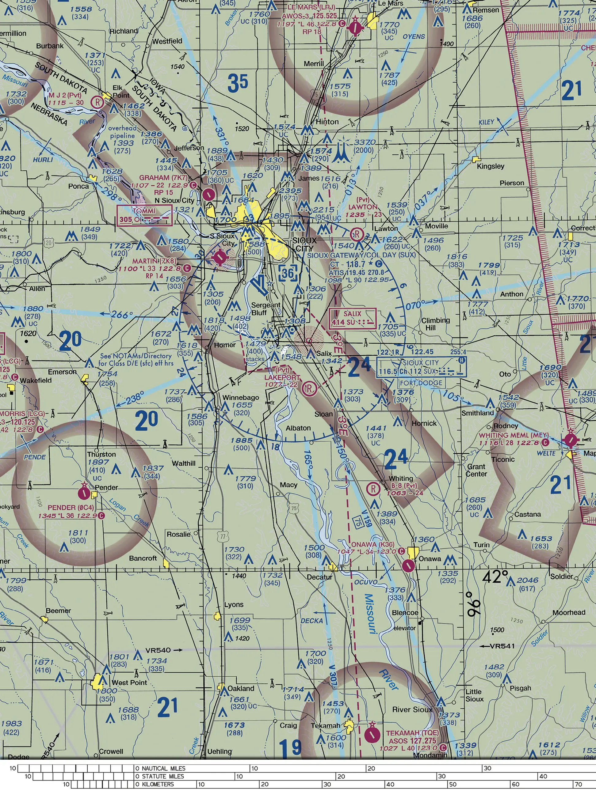
(Refer to Figure 78.) North-west of Hornick, an obstacle is charted 1376 over (309). A remote pilot flies the small UA at 400 feet AGL next to it over flat ground. How does the UA's height compare with the top of the obstacle?
- AAbout 91 feet above the top
- BAbout 976 feet below the top
- CAbout 709 feet above the top
Show answer and explanation
Correct answer: A. About 91 feet above the top
The label gives the top at 1,376 feet MSL and, in parentheses, the height of 309 feet above ground. Both the UA's altitude and the 309 are measured from the same flat ground, so the UA is 400 - 309 = 91 feet above the obstacle's top.
- A. Correct. The obstacle is 309 feet above the ground, so a UA at 400 feet AGL is 400 - 309 = 91 feet above its top.
- B. Incorrect. This subtracts an AGL altitude from the MSL top elevation (1,376 - 400); the two values use different references.
- C. Incorrect. This adds the obstacle height to the flight altitude (400 + 309) instead of comparing them.
Marked on Figure 78: Obstacle 1376 (309) north-west of Hornick.
FAA Chart Users' Guide (Aeronautical Chart User's Guide), complete, VFR Terms and Symbols, Land Features (Terrain) and Obstructions The AGL height is in parentheses below the MSL elevation.
FAA Chart Users' Guide (Aeronautical Chart User's Guide), complete, VFR Terms and Symbols, Land Features (Terrain) and Obstructions The elevation of the top of the obstacle above Mean Sea Level (MSL) and the height of the structure (AGL) is also indicated (when known or can be reliably determined by a Specialist).